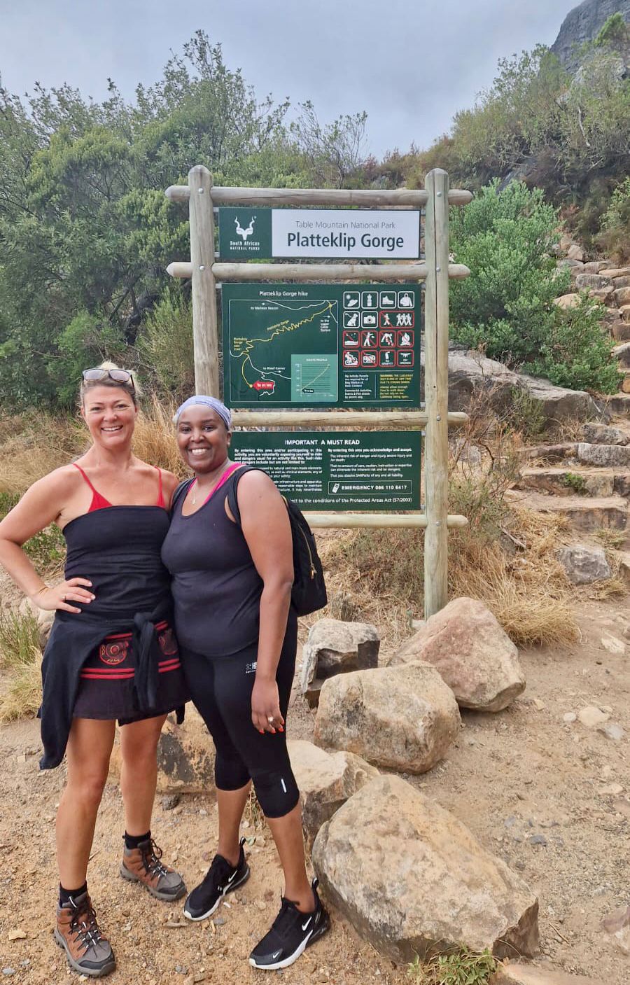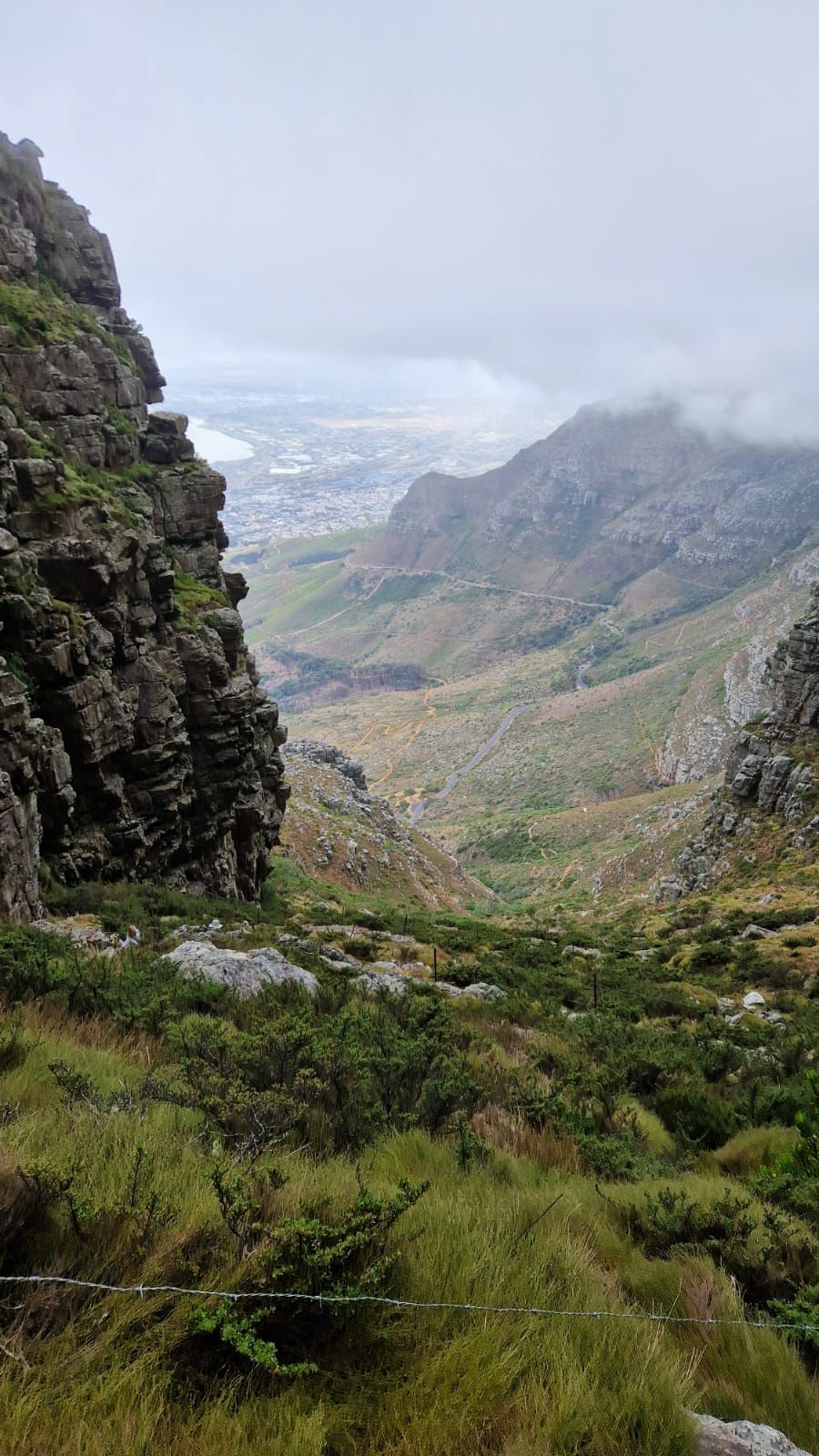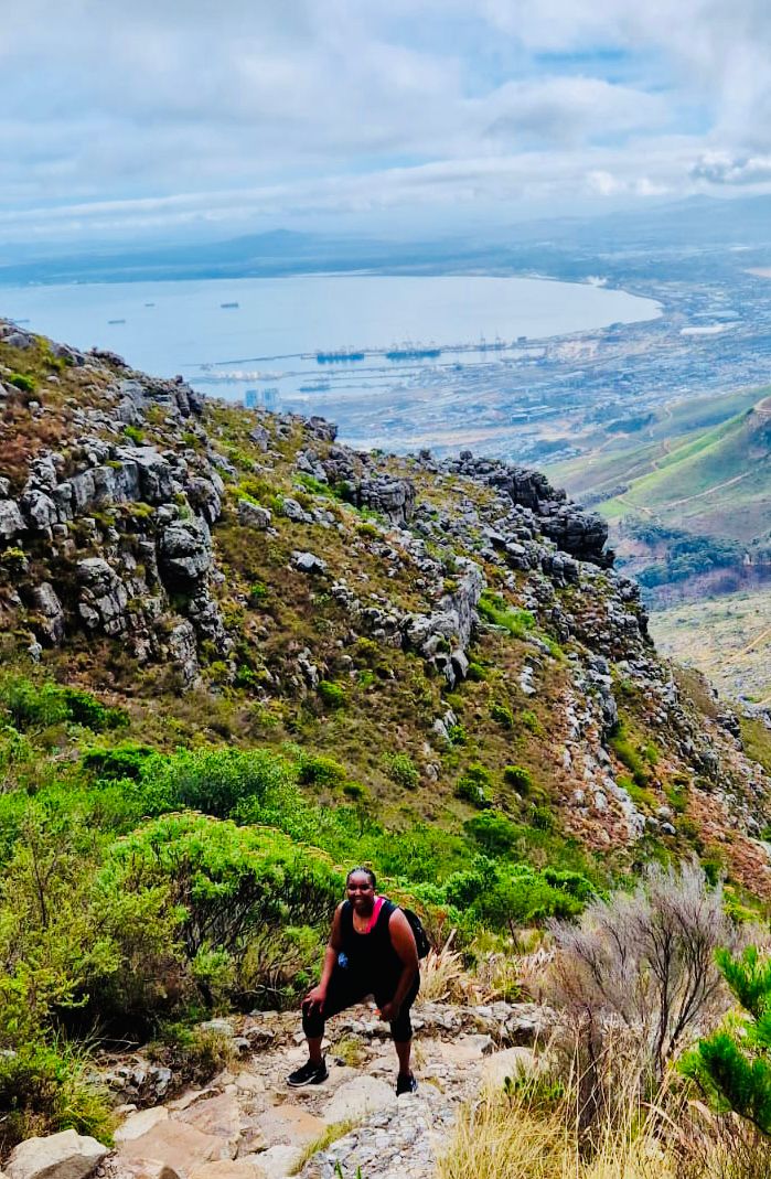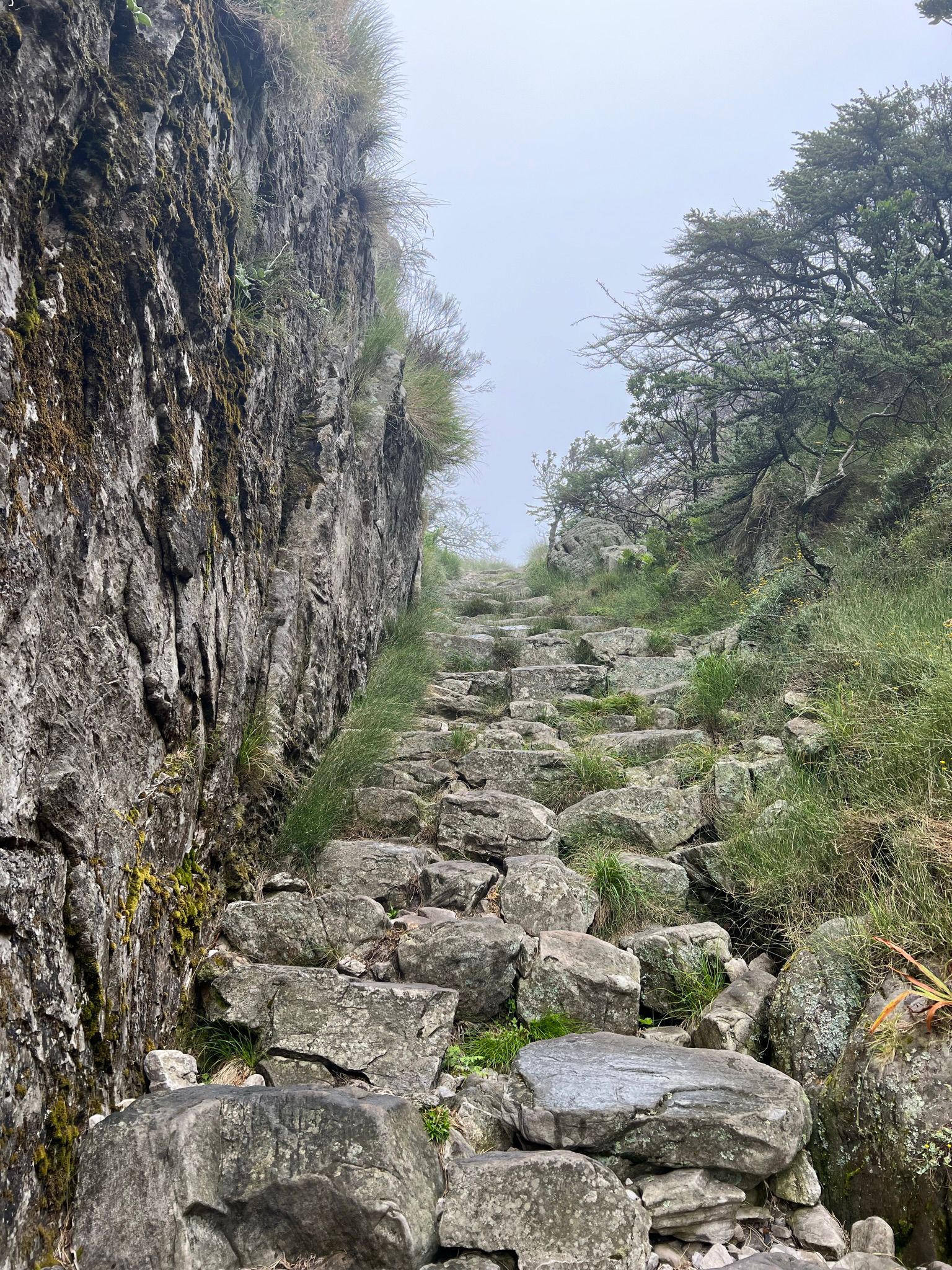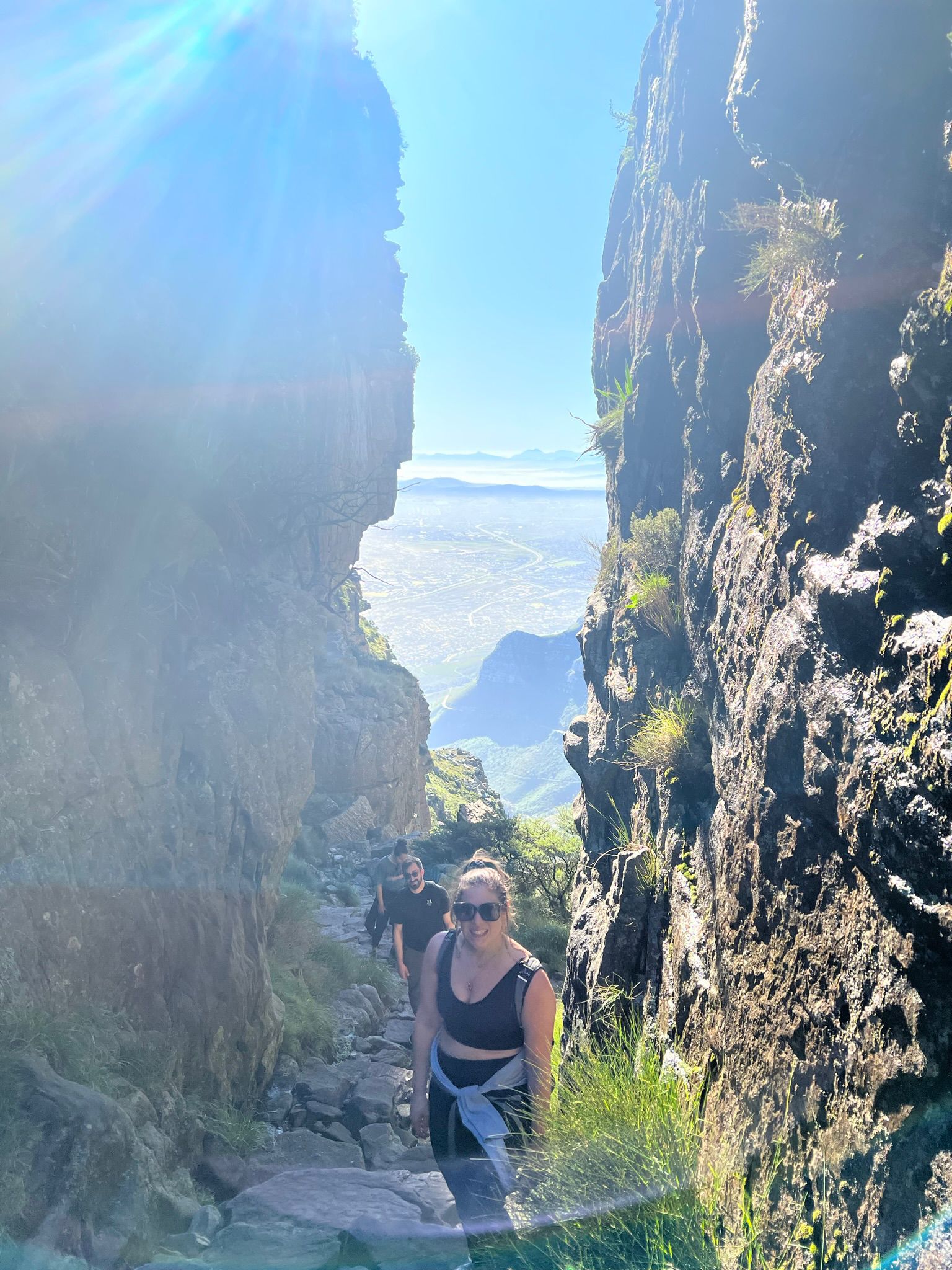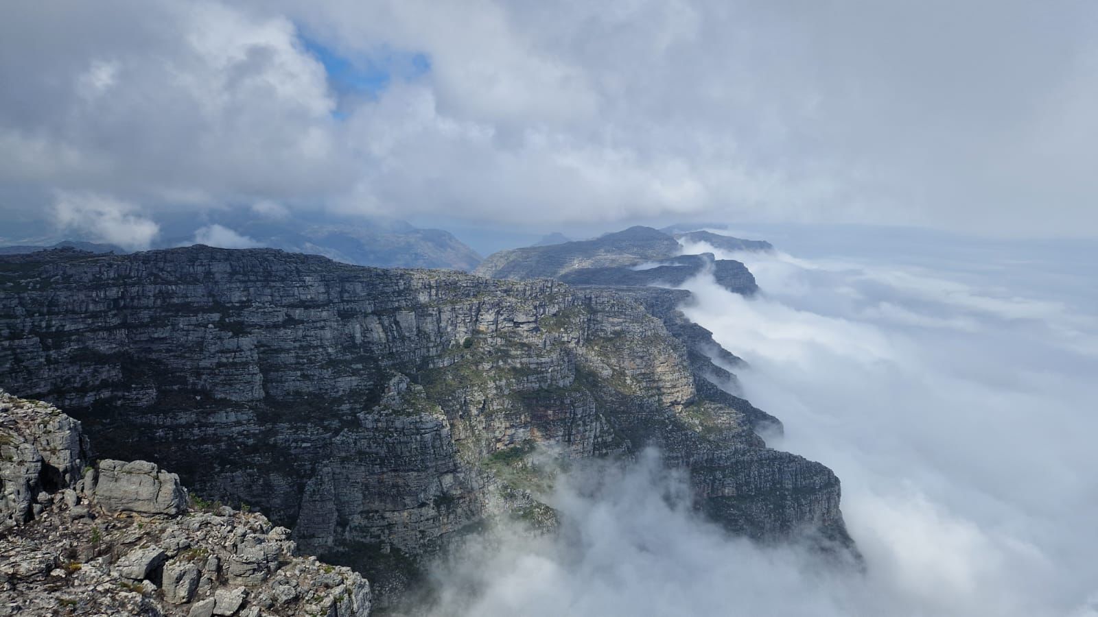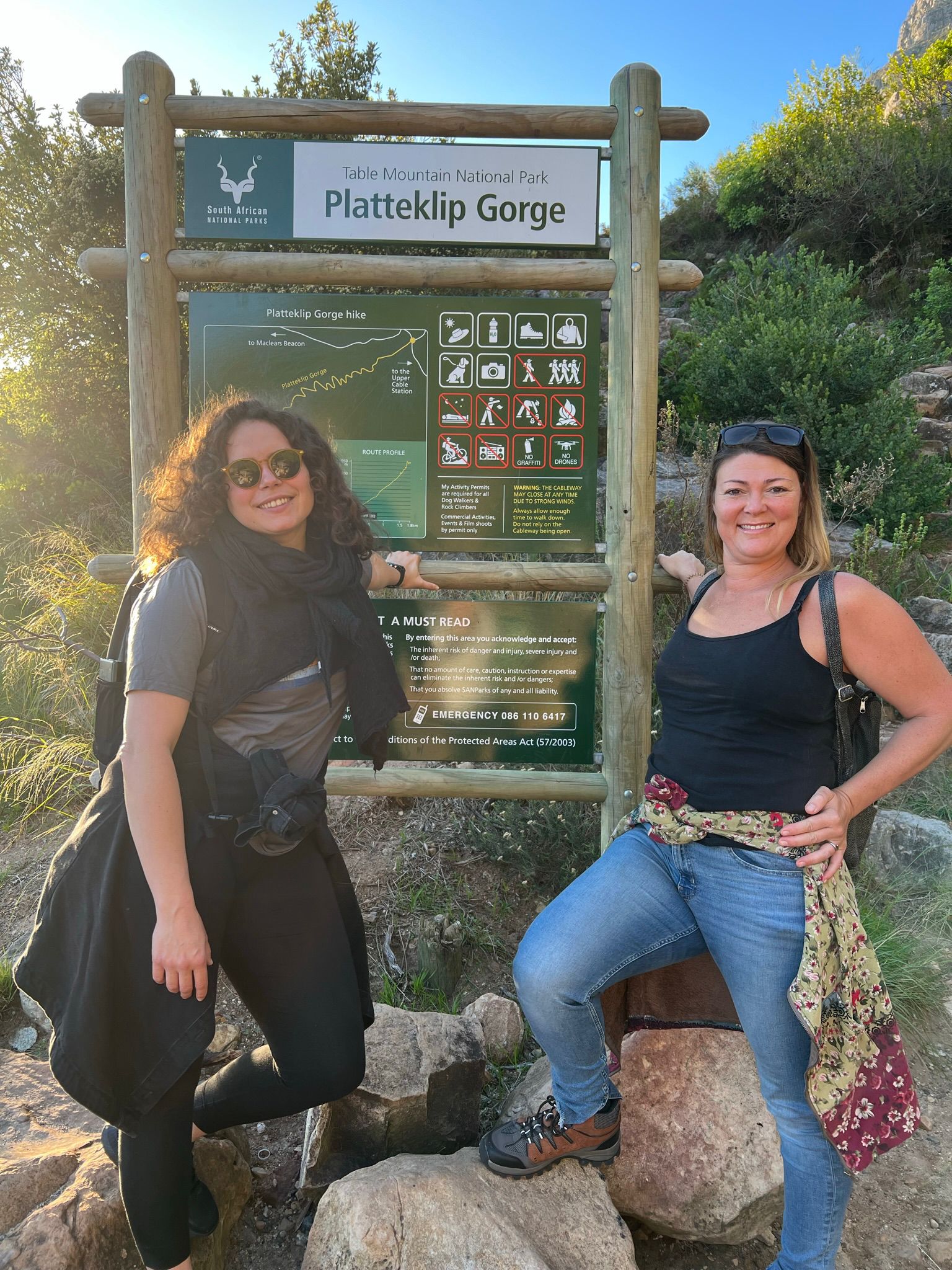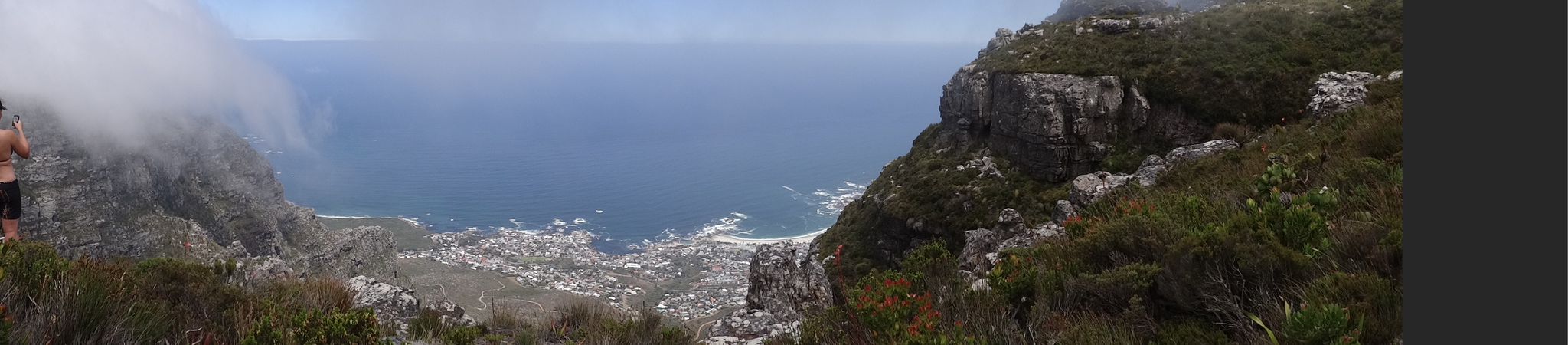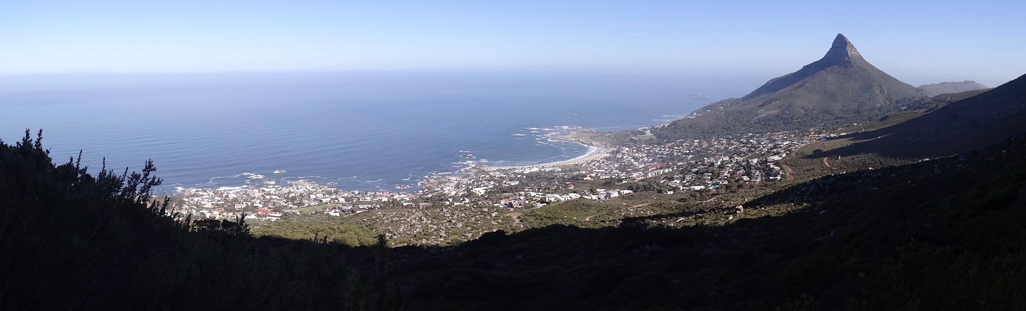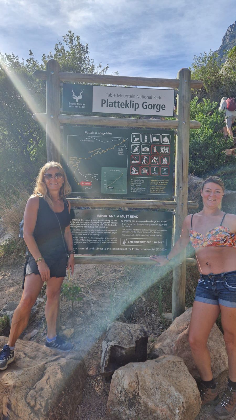
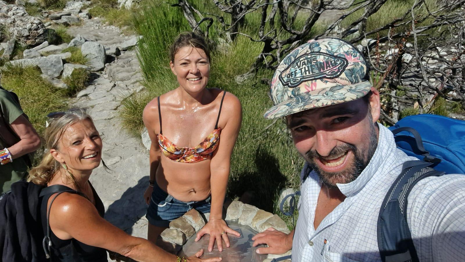
Probably the most well-known hike in Cape Town, and the easiest one to see, as it treks up the face of Table Mountain, Platteklip Gorge provides a straight-up direct route to the summit. Although there aren’t any ladders, or rock climbing, it is pretty much a vertical ascent for about 3km! Best done with multiple short breaks, so that your muscles don’t cool too much, and with a few high energy drinks or snacks to keep you powering up.
Start point Tafelberg Road
End point Upper Cableway Station – or any one of the trail options down
Duration Anywhere between 1.5 -3 hours up, depending on your fitness, some super fit people run up and down the trail in 90 minutes.
FYI Platteklip is best avoided in the middle of the day, as there is no shade for the initial ⅔’s of the walk and can get blisteringly hot. We have found the best time to start the walk is before 8am. Also, as it is a gorge, it often works as a channel for the mountain winds, so be prepared for extremes of temperature, and even rain – bring a hat, sunblock and a warm windproof jacket.
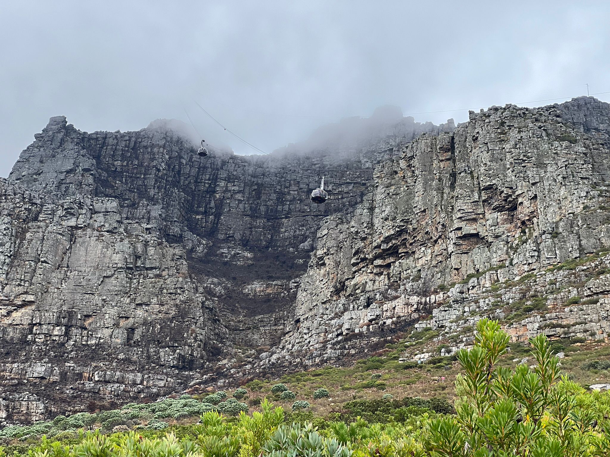
If you plan to take the cable car down, make sure to check before you leave that the cable car is operational that day. Give yourself enough time to reach the station before the last car leaves: 5pm (winter), 7pm (spring & early summer), 7.30pm (summer, except 15 December – 15 January when it leaves at 9pm).
Important note the South African National Parks Agency for South Africa (SANParks), perform many rescues at this site, as people underestimate the heat/cold weather and level of fitness required, or they miss the last cable car and end up stranded on the mountain at night.
Child-friendly? Yes, for fit and older children
Dog-friendly? Not recommended if they are new to walking or you choose to walk later in the day. They are also not allowed to ride in the cable car
Contact 021 422 1601 (SANParks Kloofnek Office)
TMNP emergency numbers: 086 110 6417, 107 or 021 937 0300
Cableway weather/operational updates: 021 424 8181
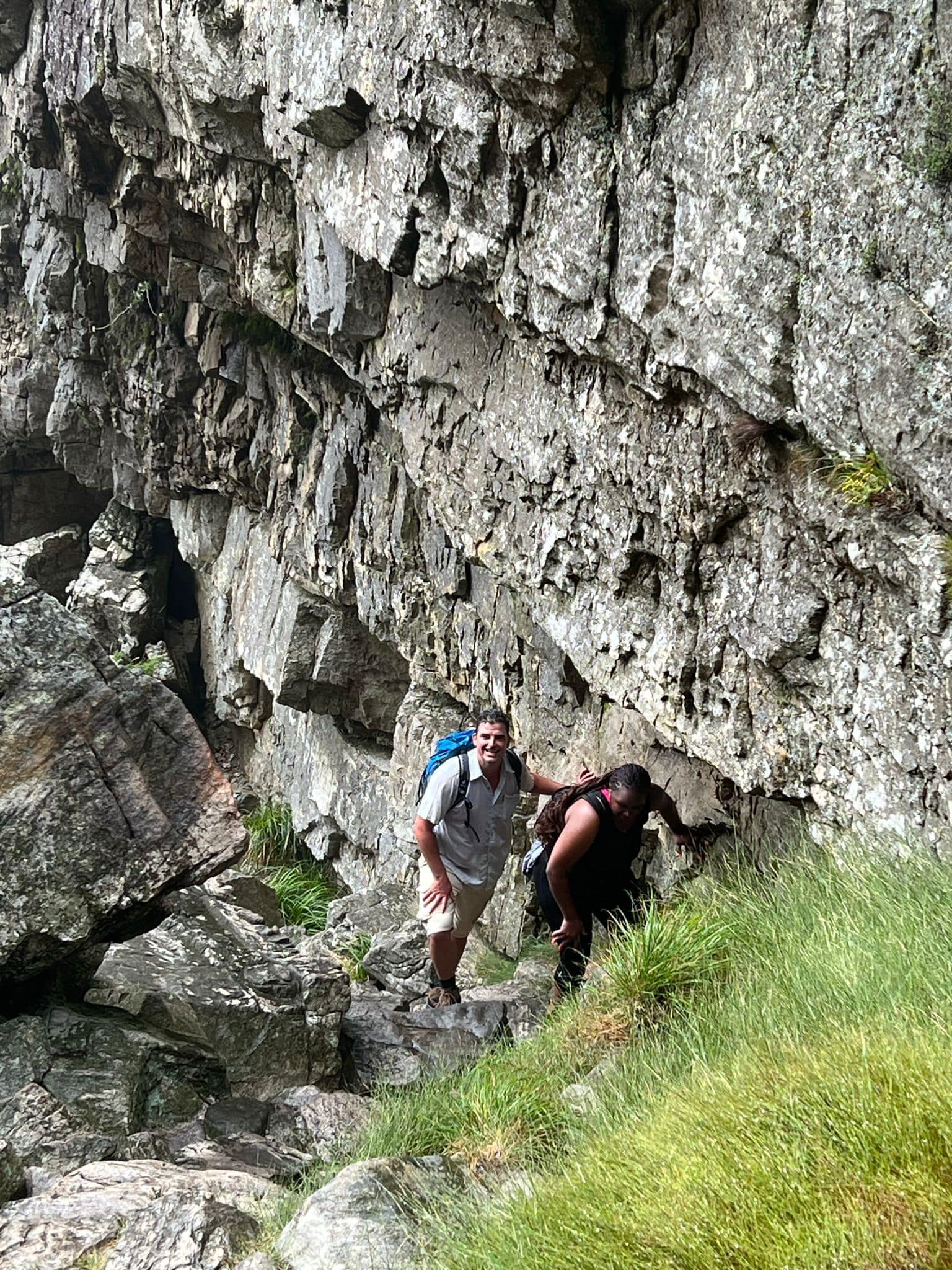
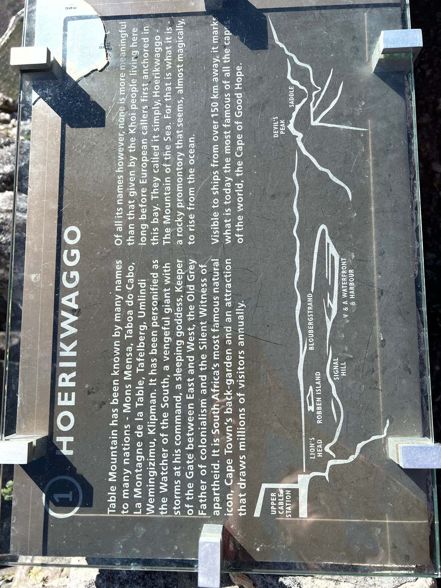
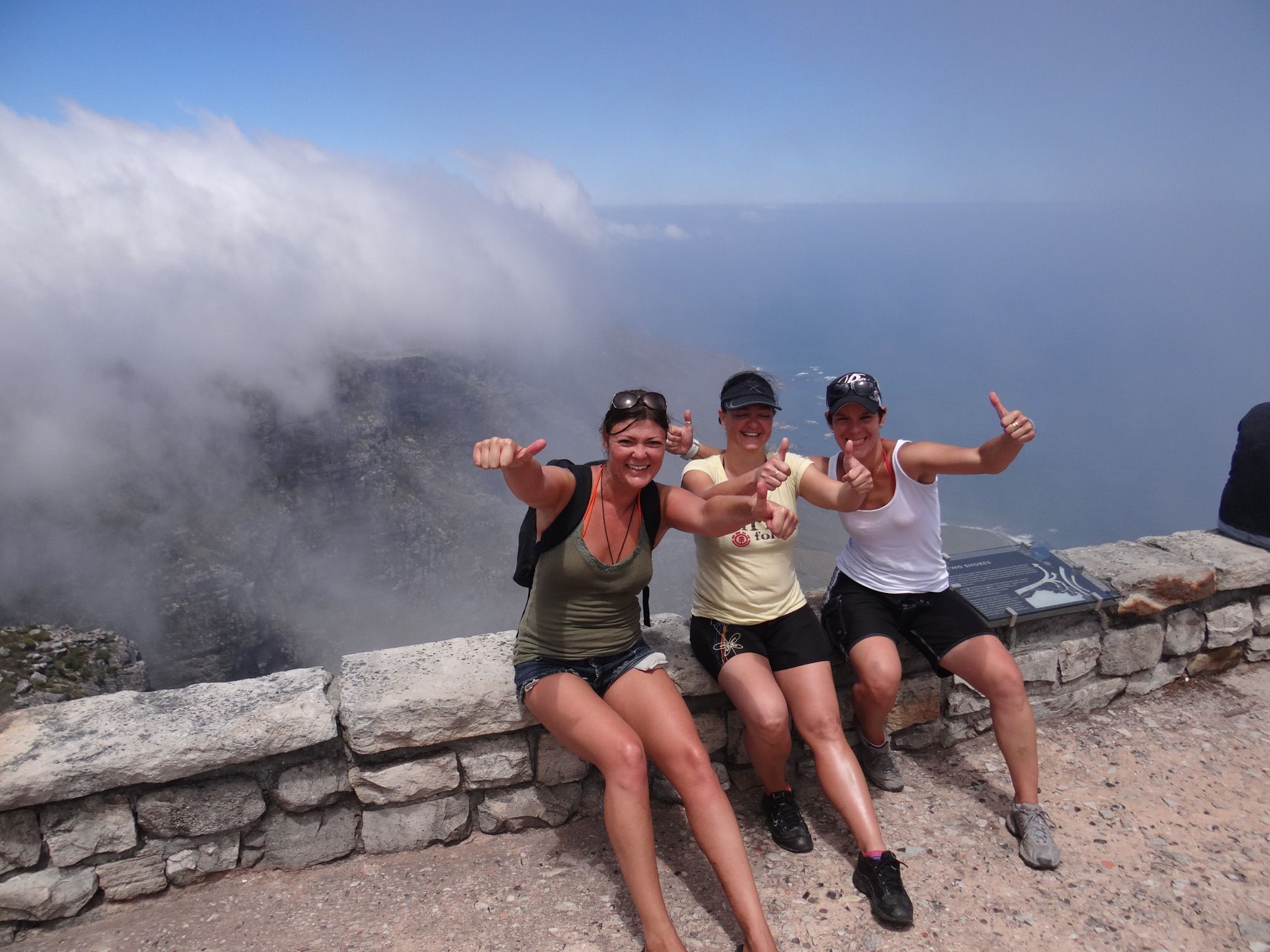
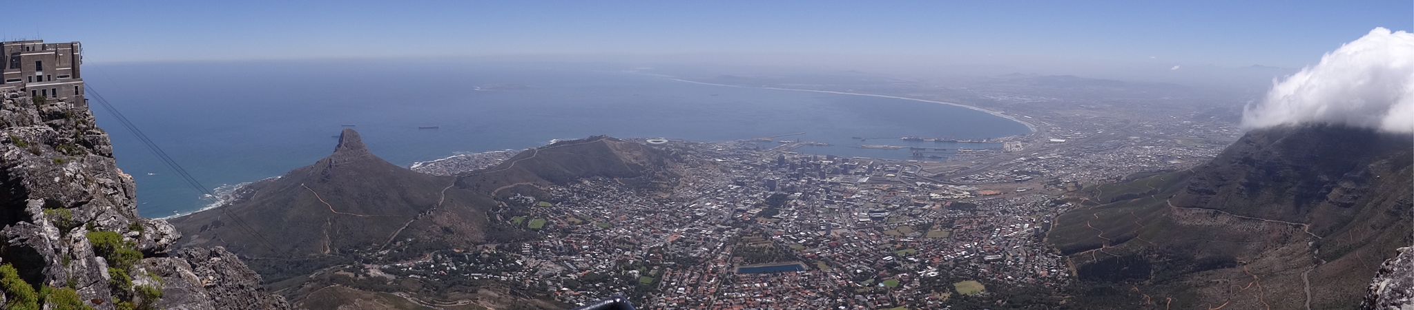
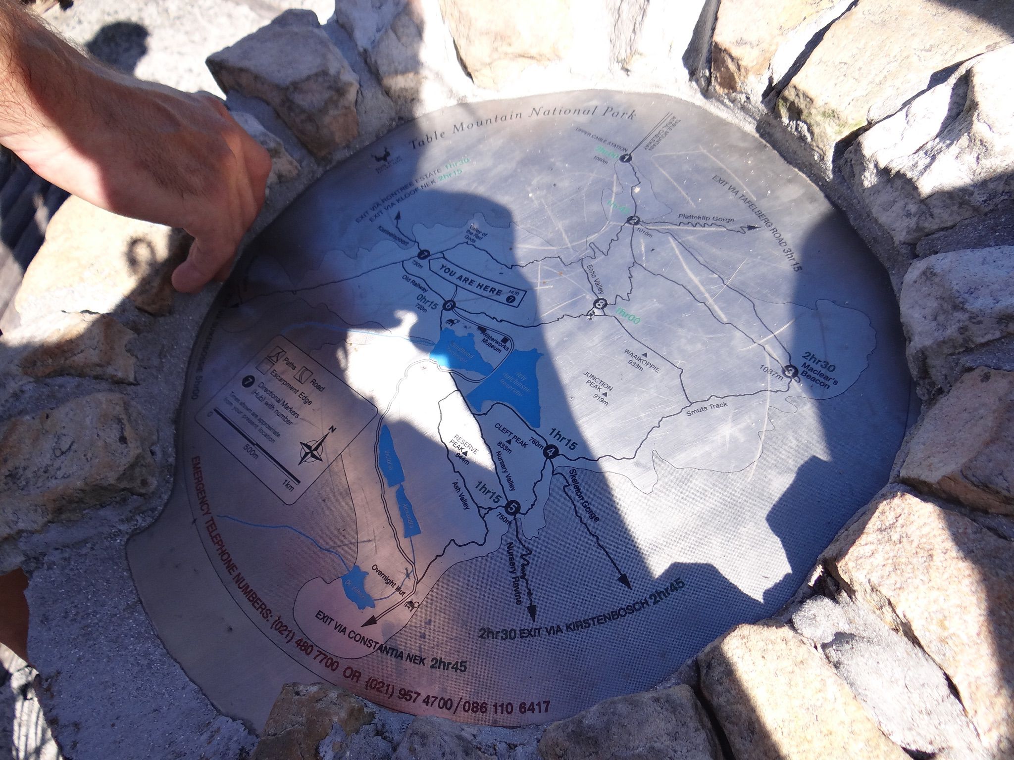
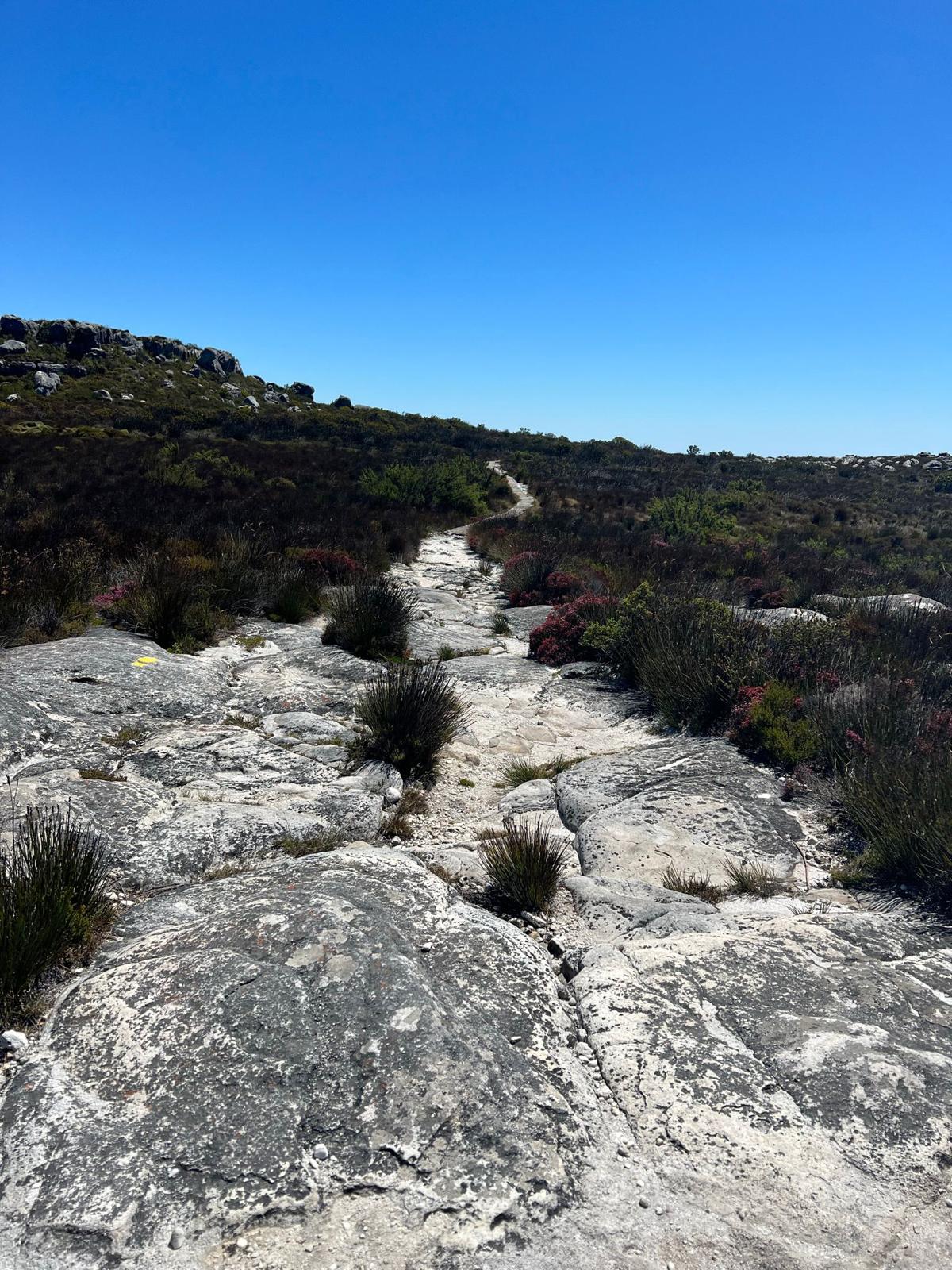
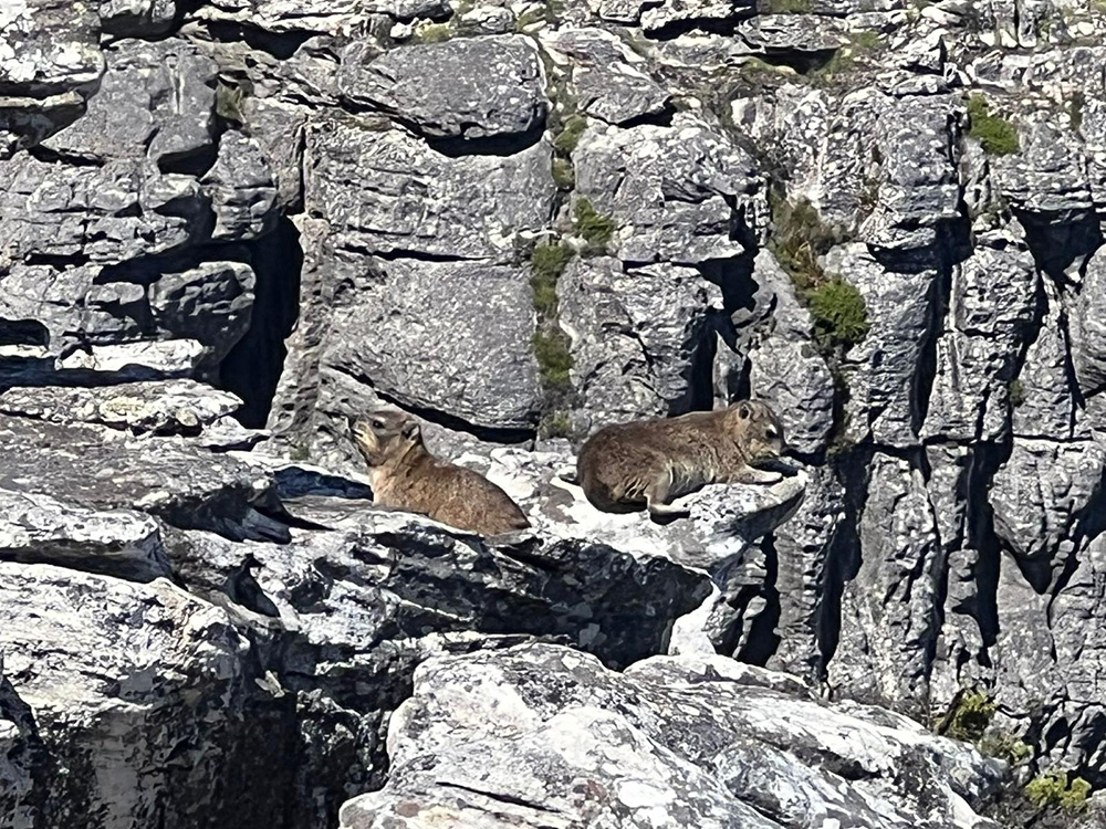
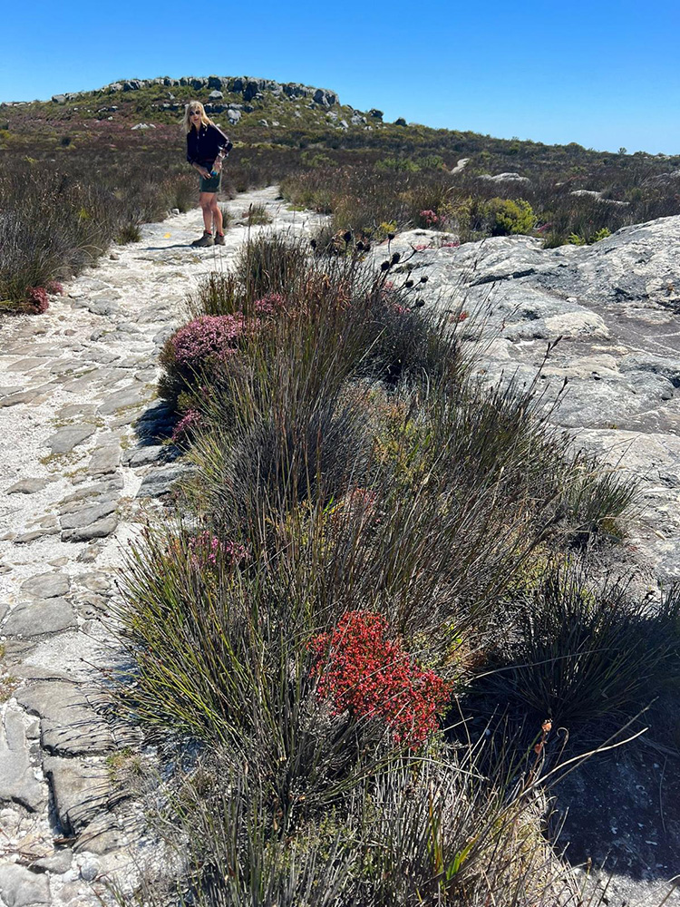
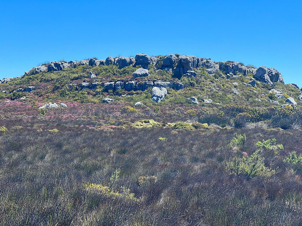
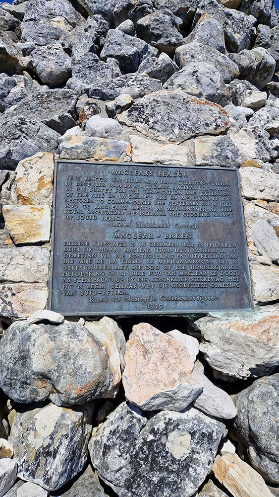
Maclear’s Beacon is the official highest point on Table Mountain (1 088m) sitting at 21 metres above the Upper Cableway Station. Look out for signs at the cableway station that point you towards the beginning of the hike. The 5.5km trail is marked by yellow footprints for your easy guidance. Many hikers combine the Platteklip and Maclear’s Beacon trails in one go, as it is from the bottom of Table Mountain to the very top!
Start point Upper Cableway Station
End point Maclear’s Beacon
Duration 2 hour loop
FYI There is a short section of rocky steps on the edge of the mountain that needs to be negotiated using chains and handholds. Do not attempt this trail in cloudy or misty weather, as it can become slippery or disorientating
Child-friendly? Yes
Dog-friendly? No (and they are not allowed in the cable car).
Contact 021 422 1601 (SANParks Kloofnek Office), 021 712 7471 (SANParks Tokai Office)
TMNP emergency numbers: 086 110 6417, 107 or 021 937 0300
Cableway weather/operational updates: 021 424 8181
Offering magnificent 360-degree views of the city, Table Mountain, the Twelve Apostles, Table Bay and the Atlantic Seaboard, Lion’s Head challenges Platteklip Gorge as a firm favourite for hikers. It starts off with a fairly easy spiral ascent of 2km, with a bit of climbing near the top using handholds and chains to assist you in reaching its 669m top spot destination. There are two paths to choose from when you get to this bit, one that is quite a bit more challenging with ladders and vertical drops, and one that is a bit more manageable. If you like night time hikes, check out for sunset and full moon led group hikes (head torch needed!).
Start + end point Signal Hill Drive, at the base of the Forestry Road.
Duration 2 – 3 hours there and back
FYI If you would prefer to avoid the gnarly climbing and chains, the roundabout route (that’s still quite steep) adds 30 minutes to your hike.
Child-friendly? Yes, although the roundabout route is recommended for them.
Dog-friendly? No
Contact 021 422 1601 (SANParks Kloofnek Office)
TMNP emergency numbers: 086 110 6417, 107 or 021 937 0300
Devil’s Peak gets its awesome name from the Legend of Van Hunks, a Dutch pirate. Be aware, this hike is not for beginners. If you are an experienced hiker though, don’t miss out on the numerous breathtaking vantage points for gazing out over the cityscape. Walking along The Saddle – the section that connects Devil’s Peak and Table Mountain; is definitely one of the main highlights, from there you ascend to the peak’s summit at 1 000 metres.
There are three possible paths;
– the Tafelberg Road route (2.8km) is best suited to beginners.
– The Mowbray Ridge route (5km), which starts at Rhodes Memorial, is a more tricky ascent, traversing the Knife Edge;
– the Newlands Ravine route (3.9km) is challenging but well shaded by beautiful indigenous forest.
Start + end point Tafelberg Road (2.5km from the Lower Cable Station) / Rhodes Memorial (via King’s Blockhouse for Mowbray Ridge or the Contour Path for Newlands Ravine)
Duration 4 – 5 hours
Need to know Come prepared for icy winds, which can cause a drop in temperature of 10˚C. The closer you get to the summit, the more challenging the hike becomes, including some scrambling across the Knife’s Edge. Not suitable for those who have a fear of heights.
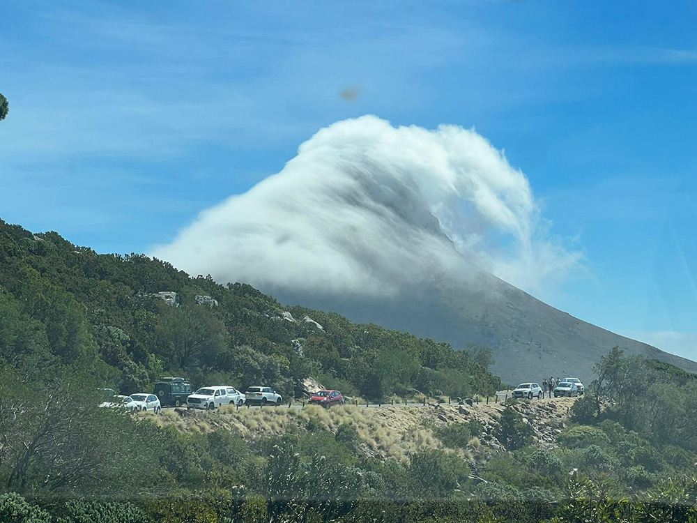
FYI The legend tells of a Dutch pirate, Van Hunks, who liked to sit on the mountain and smoke his pipe. One day a stranger dressed in black was sitting in his usual spot. The stranger challenged Van Hunks to a contest to see who could smoke his pipe the longest. As the two of them puffed away, a huge cloud of smoke covered the mountain like a tablecloth. Van Hunks finally admitted defeat, only for his opponent to reveal his true identity: he was none other than the Devil himself. So when you see clouds billowing over Devil’s Peak, think of Van Hunks puffing away on his pipe for all eternity.
Child-friendly? Yes, fit and older kids should be fine on the Tafelberg route.
Dog-friendly? Yes, with a SANParks My Activity Permit, obtainable from the Tokai Plantation Office (021 712 7471).
Contact 021 422 1601 (SANParks Kloofnek Office)
TMNP emergency numbers: 086 110 6417, 107 or 021 937 0300
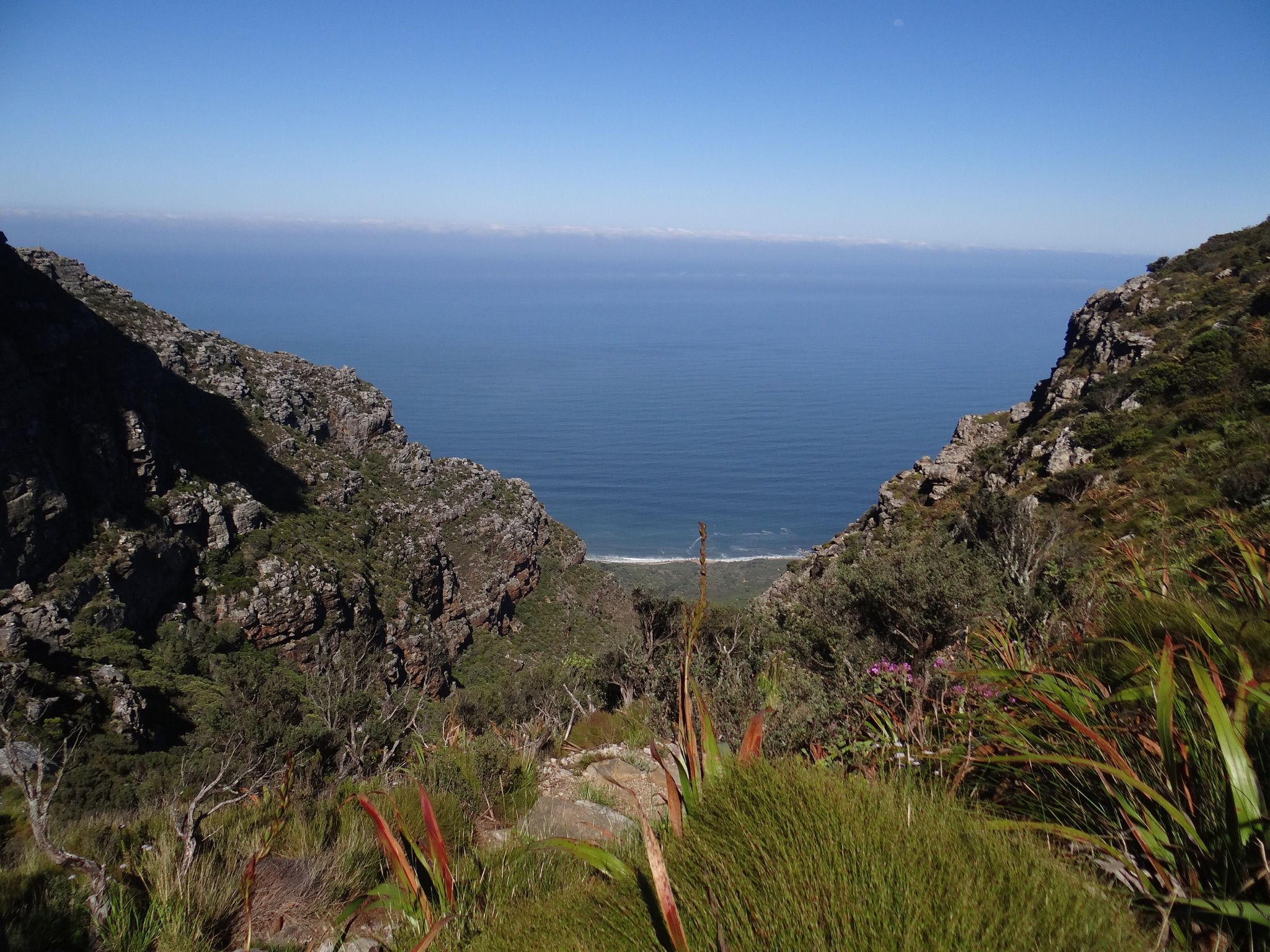
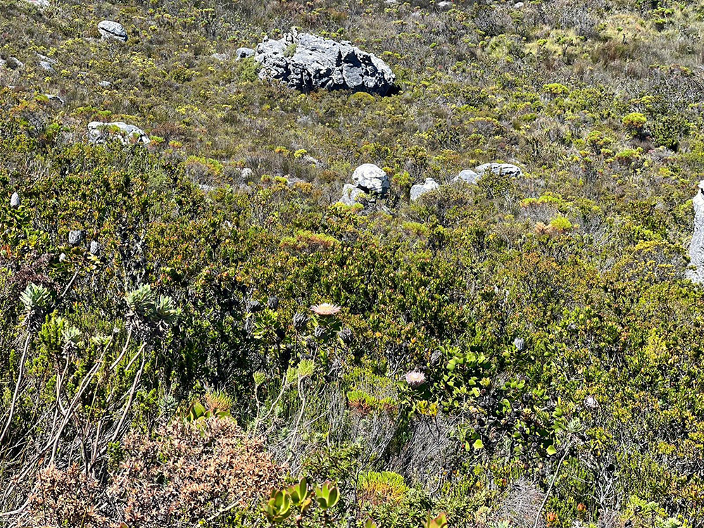
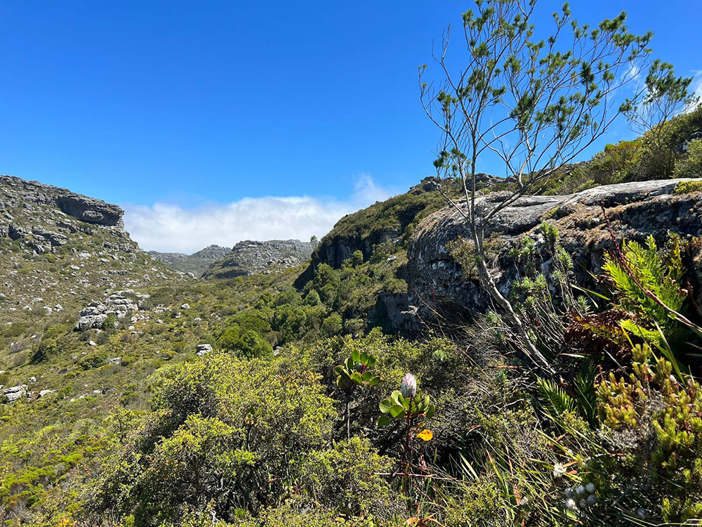
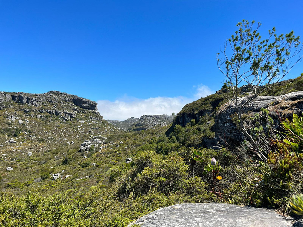
Kasteelspoort Trail is a 6.5km hike along the Western ‘Twelve Apostles’ side of Table Mountain, giving the hiker full views of the Atlantic Ocean, Camps Bay and beyond. Once at the top, there are paths leading to different points of interest – such as the Diving Board (a rocky ledge popular for photos), the remains of the 1890s steam-engine cableway (used to haul supplies up to the summit to build the two dams) and the two reservoirs that sit on top of the mountain. To take the cable car back down, you’ll need to make the undulating trek through the Valley of the Red Gods (a poetic name for our beautiful Disa flowers) and Echo Valley.
Start point On the Pipe Track (via the Theresa Avenue jeep track above Camps Bay); turn left once on the track to access the signposted trailhead.
End point Top of Table Mountain (Woodhead and Hely-Hutchinson Reservoirs / Upper Cableway Station)
Duration 4 – 5 hours
FYI This hike is not for beginners. It is a challenging hike, largely exposed to the sun, with a short section at the foot of Kasteels Buttress that requires some scrambling over rocks. There are also three ladders on route to the summit, and the ravine itself can be quite slippery (especially after rain). If cloudy, you will not be able to see the summit
Child-friendly? No
Dog-friendly? No
Contact 021 422 1601 (SANParks Kloofnek Office)
TMNP emergency numbers: 086 110 6417, 107 or 021 937 0300
The Pipe Track is a 6km trail that follows along the western side of Table Mountain. Originally built as a pipeline to supply Cape Town with water from the Disa Gorge in the 19th-century, the route is mostly flat and easygoing, although it becomes tougher and steeper after passing by Slangolie Ravine.
Start + end point Parking lot at the junction of Tafelberg and Kloof Nek Roads.
Duration 4 hours there and back
FYI The Pipe Track gets the afternoon sun and is best done in the morning. There are a number of trails that lead off the Pipe Track, including Tranquillity Cracks, a hidden gem that Capetonian hikers have only recently discovered (see below), but these should not be attempted without a mountain guide or by the experienced hiker. Many are not beginner-friendly, and not recommended for children or dogs, whereas the Pipe Track itself is.
Child-friendly? Yes
Dog-friendly? Yes, with a SANParks My Activity Permit (R340 for a year), obtainable from the Tokai Plantation Office (021 712 7471).
Contact 021 422 1601 (SANParks Kloofnek Office)
TMNP emergency numbers: 086 110 6417, 107 or 021 937 0300
The simplest and safest route is via the steep, sometimes tricky Corridor Ravine, which starts on the well-marked Pipe Track above Camps Bay. This ascent to the top follows clear paths but once on top, you need to feel your way, or better, take a guide, to find the left at the cairn and an ‘entrance crack’.
The Cracks themselves are a number of caves, caverns and thin slits in the rocks on the Twelve Apostles side of Table Mountain. Some of the fissures are quite deep and interlinked, creating a maze of corridors – yellowwood trees and bushes hide the entrance so this precious mystery is not visible from the outside. Beautiful, but best done with caution.
Start + end point Theresa Avenue entrance to the Pipe Track above Camps Bay.
Duration 5 hours
FYI This is a challenging 6km hike, not recommended for beginners or inexperienced hikers The Corridor is steep, with loose stones and can be slippery. Sections of the path are quite narrow. Many hikers use the nearby Kasteelspoort Trail (see above) to get back down.
Child-friendly? No
Dog-friendly? No
Contact 021 422 1601 (SANParks Kloofnek Office)
TMNP emergency numbers: 086 110 6417, 107 or 021 937 0300
This leafy, green trail offers a network of paths that boast a variety of rocky patches, wooden boardwalks, streams, bridges, waterfalls, as well as a bunch of other treats for any nature lover, including a scenic timber picnic carousel at which to enjoy your lunch. Head up to the Contour Path via the Skelmkoppad and Fernwood Track or Middelpad, or to Rhodes Memorial on the Woodcutters Path (these are only the main routes – there are many other possibilities).
Start point Parking lot near Newlands Fire Base, Union Avenue (M3), Newlands
End point Back where you started, or Rhodes Memorial or even Kirstenbosch (if you’ve followed the Contour Path).
Duration Varies, 1 – 4 hours
FYI It’s open daily from 8am to 6pm, but is officially closed from June to September (due to winter rains). Go early, as it can get very busy. Have a map (take a snapshot of the sign at the start of trails) or an understanding of the network, as it’s easy to become disoriented.
Child-friendly? Yes
Dog-friendly? Yes, with a SANParks My Activity Permit, obtainable from the Tokai Plantation Office (021 712 7471).
Contact 021 422 1601 (SANParks Kloofnek Office)
TMNP emergency numbers: 086 110 6417, 107 or 021 937 0300

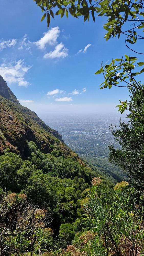
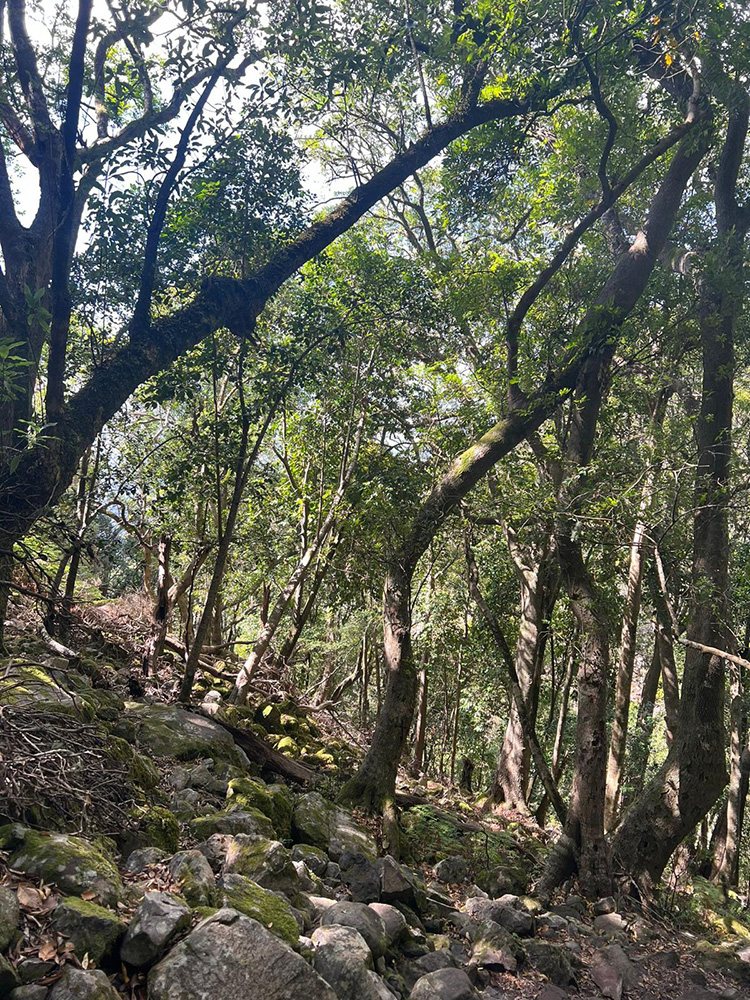
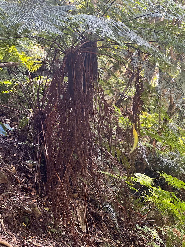
This epic 7km hike transverses Table Mountain, which requires a bit of planning for drop off and collection – very much worth the efforts though! And although this hike isn’t too affected by the sun, you will want to think about afternoon traffic to go and collect your car, if you left it at the starting point. Starting off in Kirstenbosch Gardens, you head up Smuts Track and Skeleton Gorge, where the enchanting forest provides shade for the first half of the hike. Along the way, you’ll encounter a stream, typical mountain fynbos and some interesting rock formations, before arriving at the top. Head straight to see the Hely-Hutchinson Reservoir with its white-sand beach, head left to access Nursery Ravine (a good alternative for going back down), or head right to Maclear’s Beacon, the highest point on the mountain, where you can take a well-earned rest and enjoy panoramic views of the city, ocean and Robben Island.
Start point Fragrance Garden, Kirstenbosch Gardens, Newlands
End point Maclear’s Beacon
Duration 2 – 3 hours ascent, depending on your fitness level. Add on Maclear Beacon and you’re looking at an exhilarating 5-6 hour hike to the Upper Cableway Station
FYI This is a long and steep hike, with ladders to assist climbers to the top and a rockfall to overcome, meaning you must be fit and have your wits about you. Parts of the gorge can be quite slippery, even in summer. Avoid this route during and after heavy rainfall. There is an entry fee for Kirstenbosch is (SA + SADC nationals with ID). African nationals pay slightly more and international adults pay more again. Check SANParks or Kirstenbosch Gardens for the latest fees. Kirstenbosch opens at 8am and closes at 7pm (6pm winter).
FYI Nursery Ravine, which runs down parallel to Skeleton Gorge , offers an easier descent, This makes them a popular pairing, with one trail being used for going up and the other for coming down.
Child-friendly? Yes, for fit and older kids
Dog-friendly? Yes, depending on the dog and their hiking fitness
Contact 021 422 1601 (SANParks Kloofnek Office), 021 712 7471 (SANParks Tokai Office)
Kirstenbosch: 021 799 8783, kirstenboschinfo@sanbi.org.za
TMNP emergency numbers: 086 110 6417, 107 or 021 937 0300
This easy, mostly flat 6km walk laso takes a bit of planning for drop off and pick up, but is totally worth it! Throw in a meander through the Kirstenbosch Gardens or a picnic/restaurant finish and it becomes a complete adventure. This dirt path is mostly flat, with a few uphills in the beginning and downhill at the end. Along the way you’ll enjoy the greenery of the Cecilia Forest, cross several streams over wooden bridges, pass lush ravines and gorges hiding waterfalls, and have an aerial perspective over the Constantia Winelands and Kirstenbosch, and views of False Bay. Start point Constantia Nek parking area, off Rhodes Drive
End point Kirstenbosch Botanical Garden
Need to know The walk starts on jeep track, then joins the Contour Path around 30 minutes into the walk (take the path marked ‘Contour Path/Nursery Ravine’). Continue on the Contour Path until you reach the signpost for Skeleton Gorge – don’t head up, but down along Smuts Track, to get to Kirstenbosch.
Duration 2 – 3 hours, excluding picking up your car or alternative transport back to origin
Child-friendly? Yes
Dog-friendly? Yes, on a leash – but dogs are not allowed in Kirstenbosch, if you wish to spend some time there after your hike. You can continue along the Contour Path to Newlands Forest (see below), or even around the front of the mountain to Tafelberg Road.
Contact 021 712 7471 (SANParks Tokai Office)
Kirstenbosch: 021 799 8783, kirstenboschinfo@sanbi.org.za
TMNP emergency numbers: 086 110 6417, 107 or 021 937 0300
This luscious 8km explore is hidden behind the Southern side of Table Mountain and above Hout Bay. What makes it extra-special is that access is restricted – it’s the only hiking area in Cape Town for which a permit is required, which you can get from SANParks Kloofnek Office. For the adventurous, why not explore the 19th-century Woodhead Tunnel, built to convey water to the Pipe Track. The Disa River Gorge trail heads upriver, past waterfalls and river pools and through mossy, afromontane forest, until it reaches the top of Table Mountain.
Start + end point Constantia Nek parking area, Rhodes Drive (starting on the Cecilia Forest jeep track).
Duration 8 hours (full day)
Need to know The permit is free but needs to be booked in advance – only one permit is issued per day, for maximum 12 people. The group also needs to be accompanied by a registered mountain guide. Hikers need to be fairly fit, as there is quite a bit of rock scrambling and ledge walking, and it can be slippery.
FYI For an extra bonus, if you fancy staying overnight on Table Mountain, the Overseer’s Cottage is close by (from R3 970 per night for six people; sleeps 16). Book through SANParks.
Child-friendly? Yes, older children.
Dog-friendly? No
Contact Permits: 021 422 1601 (SANParks Kloofnek Office)
021 712 7471 (SANParks Tokai Office)
TMNP emergency numbers: 086 110 6417, 107 or 021 937 0300
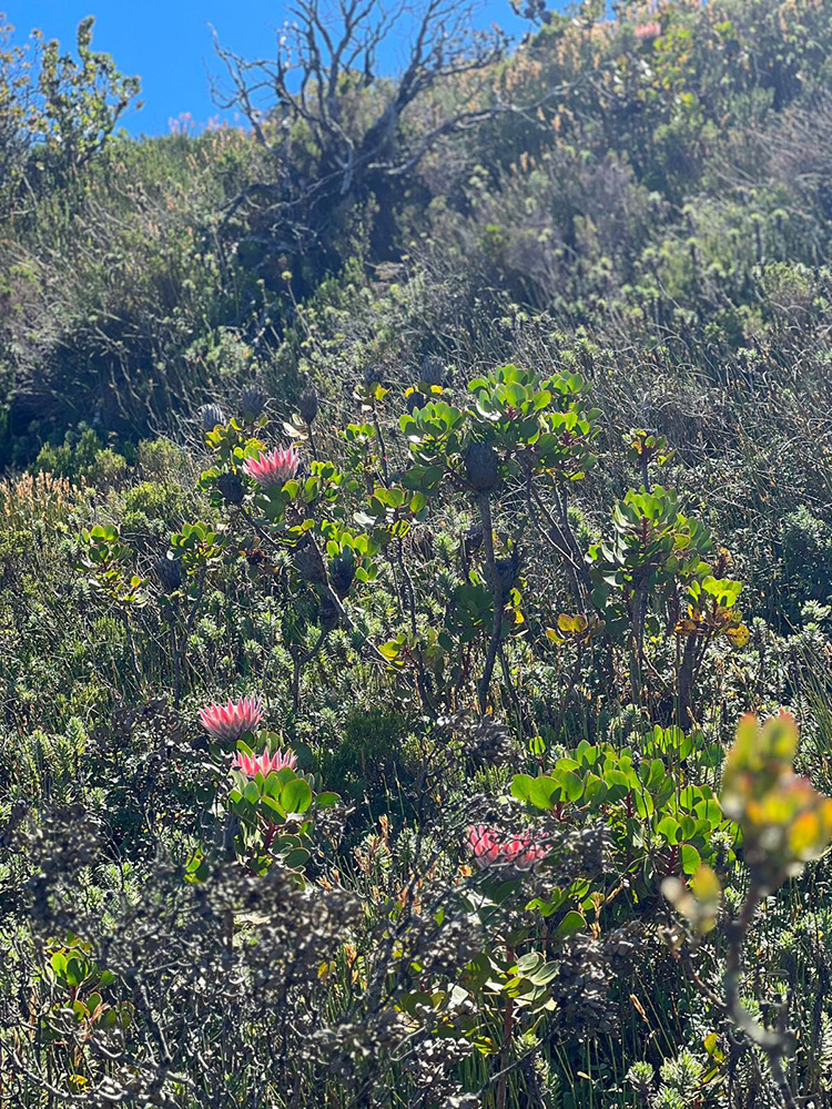
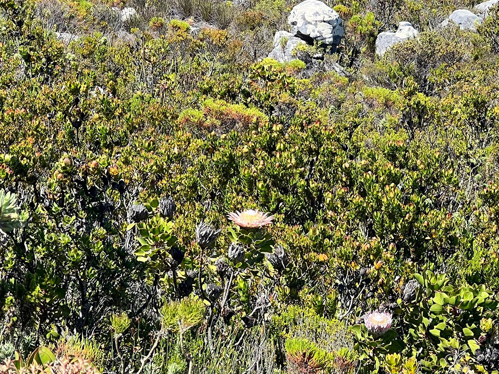
The drive to midway along the iconic Chapman’s Peak Drive might take you some time, but it’ll make this relatively short 4.6km trail (up and down) feel even better, whilst giving motorists the opportunity to stretch their legs and really take in the scenery . This hike has some of the most breathtaking views of Hout Bay’s Karbonkelberg, Klein Leeukoppie and the Sentinel peaks, the Noordhoek and Fish Hoek valleys, extending as far as Cape Point. Along the way, you’ll climb up a river valley and pass fields of proteas and ericas until you reach 595 metres above sea level. It’s especially popular in the late afternoon to catch the sunset, when the sandstone reflects the rosy hues of the sun.
Start + end point Chapman’s Peak Drive turnaround-point toll booth.
Duration 2 – 3 hours
Need to know You will need to get a free day pass at the toll booth for parking and access to the hiking trail – the pass is valid from 6am – 8pm (summer) or 7am – 6.30pm (winter). Also, remember to take a warm top or wind breaker – Cape weather is unpredictable and it can be windy at the top. The trail is mostly rocky steps, with some scrambling to reach the beacon at the summit.
Child-friendly? Yes
Dog-friendly? Yes, with a SANParks My Activity Permit, obtainable from the Tokai Office.
Contact 021 712 7471 (SANParks Tokai Office)
TMNP emergency numbers: 086 110 6417, 107 or 021 937 0300
Chapman’s Peak Toll Plaza: 021 791 8220, info@chapmanspeakdrive.co.za
This hike is for hiking enthusiasts, the super fit, like trial runners or those who don’t mind taking all day to explore this beautiful area. It spans from the top of Chapman’s Peak (593 metres), past Noordhoek Peak, then above Silvermine Dam, passing Spitskop, Bokkop and Dassenberg. Along the way there are several 360-degree panoramas viewpoints, from Hout Bay to False Bay to the far end of the peninsula. You’ll also pass the ruins of the old 17th-century silver mine, and end your hike by walking through Noordhoek’s magical greenbelt.
Start + end point About 500 metres from the end of Chapman’s Peak Drive/M6 (Noordhoek side); look for the green cycling sign “Single File Please”. There is a parking area around the bend.
Duration 8 hours or more depending on stops
FYI The hike pretty much comes full circle at Noordhoek Farm Village, which has plenty of eateries to rest, refuel and reward yourself. There is a detailed map of the route on the free Forge app.
Child-friendly? Not really; it’s a long way and quite strenuous.
Dog-friendly? Yes
Contact info@nrpa.co.za (Noordhoek Ratepayers Association)
TMNP emergency numbers: 086 110 6417, 107 or 021 937 0300
THe name for this hike comes from this section of the Constantiaberg that resembles an elephant’s head, with a cave precisely where the eye would be. Hiking to the Eye is easy enough and for much of the 5km there-and-back route you’re steeped in fynbos-smothered wilderness. What starts as a wide jeep track, with several short cuts and sidetracks to viewpoints along the way, turns into a contour path with a wee bit of scrambling as you approach the Eye. The cave itself – huge and deep, slightly mystical, moss-covered and fern-bedecked – affords a beautifully framed view of the Constantia Winelands and beyond.
Start + end point Silvermine Dam parking area, Silvermine Reserve (Gate 1), Ou Kaapse Weg (M3)
Duration 2 hours
FYI There’s also the lovely Silvermine reservoir to cool off in when you’re done with the hike. The reserve is open from 7am – 5pm (summer) and 8am – 4pm (winter). There is an entrance fee, which varies depending on your nationality and is best checked with SANParks Tokai Office. No card facilities at this entrance gate.
Child-friendly? Yes
Dog-friendly? Yes, with a SANParks My Activity Permit, obtainable from the Tokai Office.
Contact 021 780 9002 (Silvermine gate)
021 712 7471 (SANParks Tokai Office)
TMNP emergency numbers: 086 110 6417, 107 or 021 937 0300
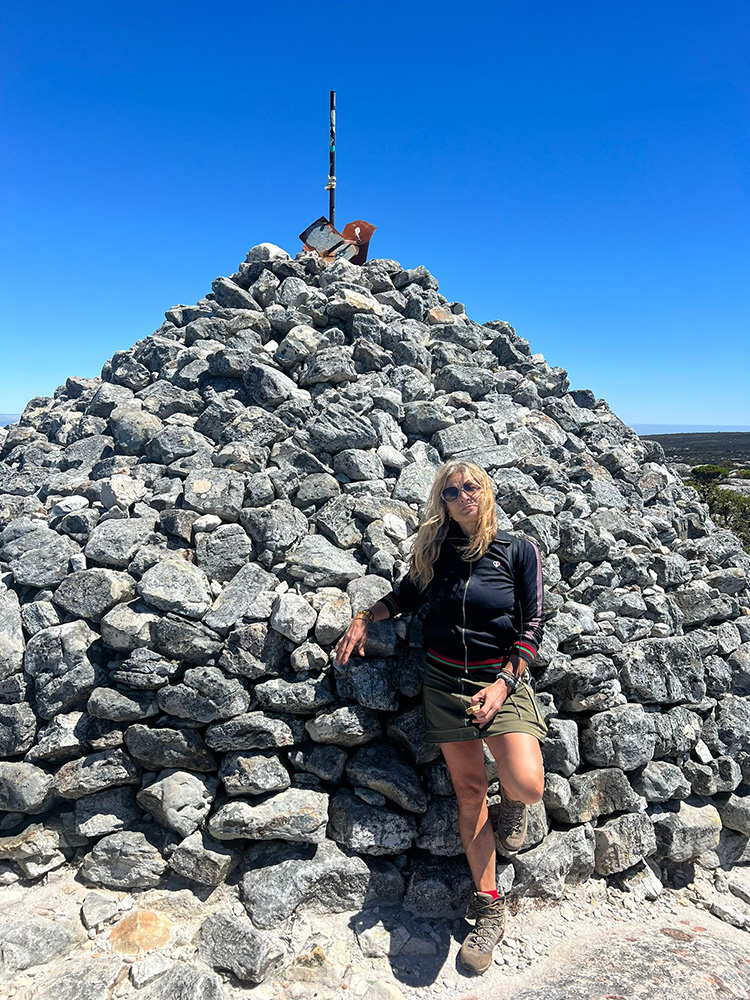
THis is a great hike for those who want to explore the other side of the mountain. Noordhoek peak sits at 754 metres, with spectacular views to behold. It’s a 7km loop hike, that heads the hiker past the Silvermine dam wall, with a steady upward walk on a wide gravel track, each gain in elevation offering increasingly better views over the Peninsula – from Muizenberg and Zandvlei to Fish Hoek, Simon’s Town and Noordhoek-Kommetjie’s stretch of beautiful white beach. At the summit (indicated by a stone cairn), you can gaze out over all of Hout Bay, down on to Chapman’s Peak Drive and across to the Atlantic’s distant horizon.
Start + end point Silvermine Dam, Silvermine Reserve (Gate 1), Ou Kaapse Weg (M3)
Duration 2.5 – 3 hours
FYI The peak is quite exposed and can be windy, so come prepared with a windbreaker. This track is also used by mountain-bikers, so keep an eye out on blind corners. The reserve is open from 7am – 5pm (summer) and 8am – 4pm (winter). There is an entrance fee, best to check with SANParks Tokai Office. No card facilities at this entrance gate.
Child-friendly? Yes
Dog-friendly? Yes, with a SANParks My Activity Permit, obtainable from the Tokai Plantation Office.
Contact 021 780 9002 (Silvermine gate)
021 712 7471 (SANParks Tokai Office)
TMNP emergency numbers: 086 110 6417, 107 or 021 937 0300
This easy 5km hike includes stretches of jeep track, rocky bits (easy scrambling) and wooden boardwalk – including the final stretch around the dam, so is great for the whole family. Along the way, you will see over 900 species of fynbos, a keurboom forest, cross over a bridge and small waterfall.
Start + end point Entrance gate parking area, Silvermine Reserve (Gate 1), Ou Kaapse Weg (M3).
Duration Around 2 hours
FYI It’s possible to braai in the reserve in winter, so pack some supplies; park a second car nearer to the dam where the braai areas are situated. The reserve is open from 7am – 5pm (summer) and 8am – 4pm (winter). There is an entrance fee, best to check with SANParks Tokai Office. No card facilities at this entrance gate.
Child-friendly? Yes
Dog-friendly? Yes, with a SANParks My Activity Permit, obtainable from the Tokai Plantation Office.
Contact 021 780 9002 (Silvermine gate)
021 712 7471 (SANParks Tokai Office)
TMNP emergency numbers: 086 110 6417, 107 or 021 937 0300
This easy, circular 4.2km hike borrows its name from the indigenous Rooiels (butterspoon) trees that you will find atop its peak. Hikers can access it from either Fish Hoek or Glencairn. The trail is clearly defined and easy,with a few rock steps in sections. The peak is quite exposed and can be windy, so come prepared with a windbreaker. There are also a few steep sections. At the summit there is a panorama view of the whole of False Bay, as far as Strand and Gordon’s Bay.
Start and end point Berg Road, Fish Hoek; or Golconda Street, Glencairn Heights
Duration 2 – 3 hours
Child-friendly? Yes
Dog-friendly? Yes, with a SANParks My Activity Permit, obtainable from the Tokai Plantation Office.
Contact 021 712 7471 (SANParks Tokai Office)
TMNP emergency numbers: 086 110 6417, 107 or 021 937 0300
Although there is much to see when driving around Cape of Good Hope Nature Reserve, nothing beats getting up close and personal, and this easy-to-follow 8km stone path does not disappoint. The path winds up and down a number of hills, passing Kanonkop, the cannon used back in the day to warn Simon’s Town of approaching ships. There are rock climbing options for the adventurous and some potential ostrich, bontebok or baboons sightseeing for animal lovers The hike can be done in either direction, but we recommend ending at Buffels Bay beach, where you’ll find a glorious tidal pool, ablution block and braai area.
Start point South end of Smitswinkel Viewpoint parking area, just under 1km from Cape Point Reserve entrance gate, Main Road (M4)
End point Buffels Bay beach
Duration 3 hours
FYI The hike is mostly exposed, so wear sunblock and a hat and bring plenty of water. Ideally done with two cars, leave one at Buffels Bay (6km from entrance gate) and take the other to the starting point, otherwise there’s a long walk there and back in the hot sun. The reserve gates close at 6pm (5pm in winter). There is an entry fee, check with SANParks Tokai Office. No cash, cards only.
Child-friendly? Yes, but it is a very long hike for them.
Dog-friendly? No
Contact 021 712 7471 (Cape Point Buffelsfontein Visitor Centre)
021 712 7471 (SANParks Tokai Office)
TMNP emergency numbers: 086 110 6417, 107 or 021 937 0300
No trip to the Cape of Good Hope Nature Reserve is complete without finishing it off with this 3.4km trail at the Cape Point itself. On this narrow path, the hiker is spoilt with high-angle views of the rocky cliffs that drop away to a wild, battered coastline, and various animal sightings along the way. If walking up sounds a bit tedious, why not ride up the Funicular car, a sure winner with those with weak knees and children that enjoy a joy ride.
Start + end point Behind the Upper Funicular Station (at the lighthouse).
Duration 1 hour
FYI Park at Cape Point’s main parking lot and walk up to the station, or catch the 3-minute funicular to save energy and time. Check with the Cape Point Buffelsfontein Visitor Centre on the latest prices.
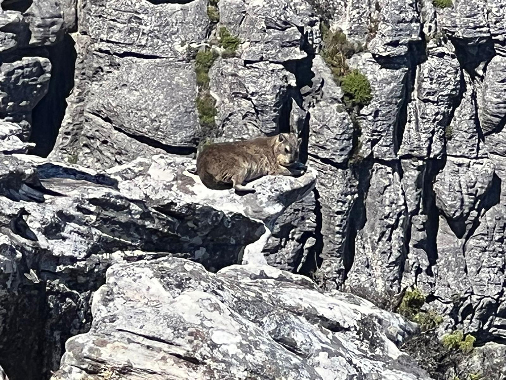
Baboons are a regular sight to behold, but visitors are reminded that they are not to be approached, and definitely do not feed them. If hikers encounter one along the path, keep calm and quiet and back away slowly. The reserve gates close at 6pm (5pm in winter). There is an entry fee. Contact Cape Point Buffelsfontein Visitor Centre or SANParks Tokai Office for latest prices. No cash, cards only.
FYI The surrounding Cape of Good Hope Nature Reserve offers several other day hiking trails, including the Shipwreck Trail along the beach at Olifantsbos, the Kanonkop Trail and Gifkommetjie Trail. Also see below.
Child-friendly? Yes (plus the ride in the funicular will be fun).
Dog-friendly? No, they are not allowed in the reserve.
Contact 021 712 7471 (Cape Point Buffelsfontein Visitor Centre)
021 712 7471 (SANParks Tokai Office)
TMNP emergency numbers: 086 110 6417, 107 or 021 937 0300
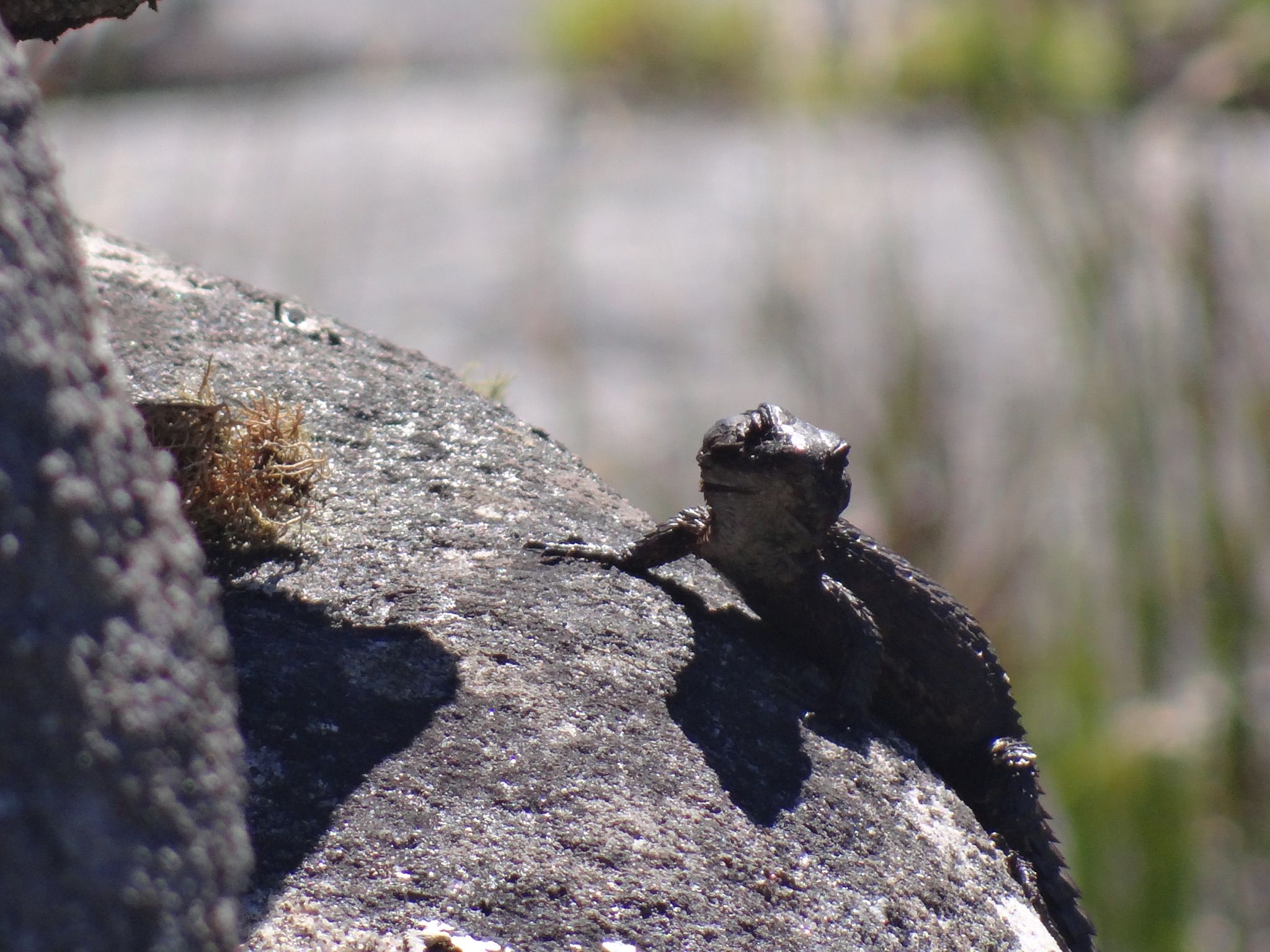
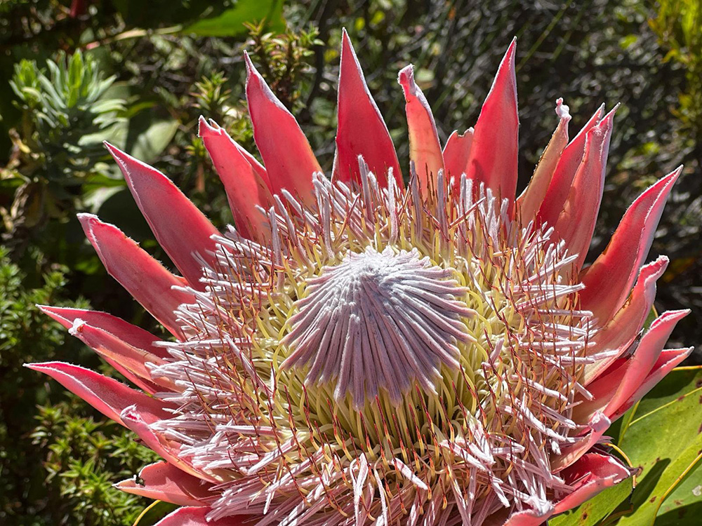
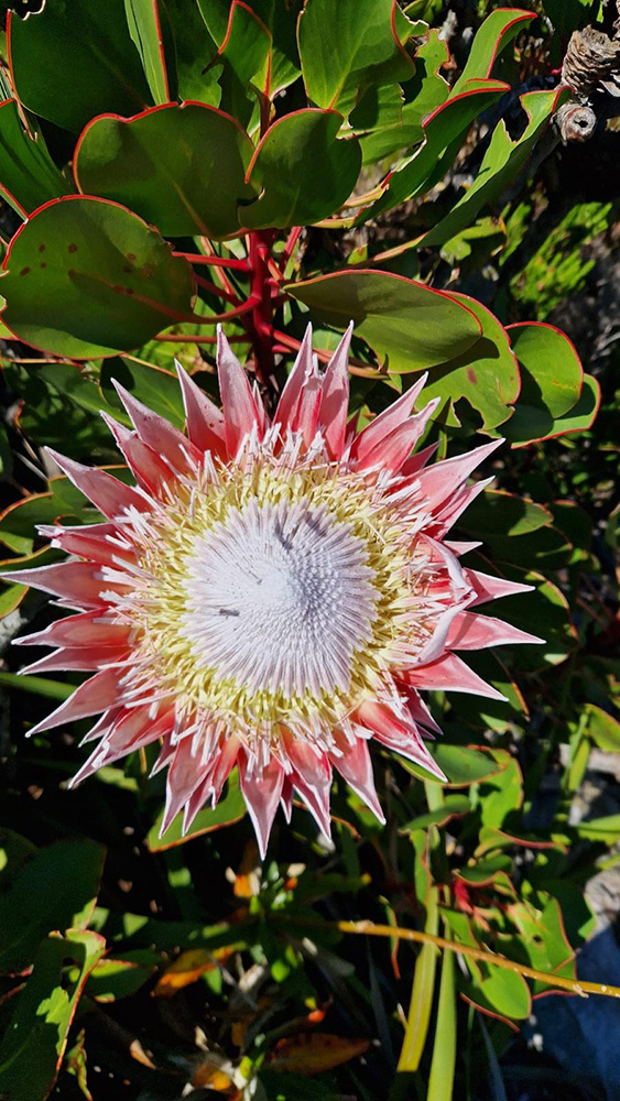
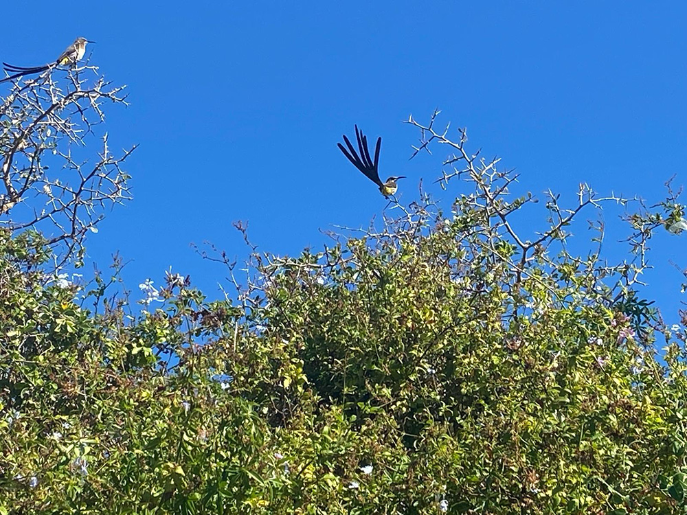
If you are looking for a trail closer to Blouberg, why not try this little gem? Nestled among the hills in Cape Town’s northern suburbs, you will find more than a few wine estates. All of the 13 well-marked, interconnecting trails within this 388-hectare reserve offers the hiker a rich diversity of plant, bird and animal life to observe, as well as spectacular views (calling all plane-spotters; check out close-ups of jumbo jets coming in to land at the airport!) Those hikers who want to explore the highest points of the reserve, the Golden Mole or Ukhetshe trails that run along the edge of the mountain, do not disappoint. There are also spectacular views to be seen from the summit of Table Mountain, Table bay and beyond
Start + end point Info Centre at Tygerberg Nature Reserve, Totius Street, Welgemoed
Duration Varies, from 380m to 3.6km
FYI The trails are easy to moderate and great for families. There is also a wheelchair-friendly trail, close to the picnic area. There’s not a lot of shade, so take plenty of water, wear a hat and sunblock, and warm clothing in winter as it gets quite chilly up top. The reserve opens at 7.30am and closes at 6pm (7pm on weekends).
Child-friendly? Yes, especially if they like critters like tortoises and chameleons.
Dog-friendly? No
Cost Check latest prices with Info Centre at Tygerberg Nature Reserve
Free for babies/toddlers and Friends of the Reserve (with proof of membership)
Contact 021 444 8971, tygerberg.naturereserve@capetown.gov.za
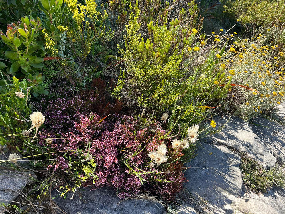
Right on Blouberg’s door step, lies this little-known reserve,which was recently declared a Provincial Heritage site, due to its extremely rare pockets of indigenous flora and its history. Enjoy a selection of insight to ancient KhoiSan shell middens and old kraals, to the 1806 Battle of Blouberg and WWII radar station, amongst some of the rarest flora to be found. It has two hiking trails – the 4.4km Coastal Dune Trail is open to the public. As it marks the start of West Coast vegetation (famous for its wildflower displays), the reserve bursts into colour in spring (September), with over 560 species blooming, covering the hills in carpets of vibrant colour, whilst the air hangs heavy with seasonal aromas. At the Enviro Centre at Eerstesteen Resort there is a pocket guide available to help you identify the different flowers. Afterwards, why not enjoy a beachside picnic or braai at Eerste Steen.
Start + end point Enviro Centre at Eerstesteen Resort, Otto du Plessis Drive (M14), just outside Bloubergstrand.
Duration 1.5 hours
FYI Check latest prices to Eerstesteen with The Enviro Centre at Eerstesteen Resort. It is open until 7pm in summer or 5pm in winter. The Coastal Trail is easy, with no hills or steep descents, although it is quite exposed to the elements. Due to its proximity to urban areas, there is a risk of criminal activity. Do not hike alone and do not display valuables – the safest option is to join a Botanical Walk (once a month on Saturdays) with a knowledgeable flora guide. There is also a second hike, the 7.3km Two Hills Trail, which is opened once a month for a guided history-focused walk.
Child-friendly? Yes
Dog-friendly? No
Contact 021 444 0454, blaauwberg.naturereserve@capetowngov.za
Friends of Blaauwberg Conservation Area: hike@bca.org.za
Emergency: 021 480 7700
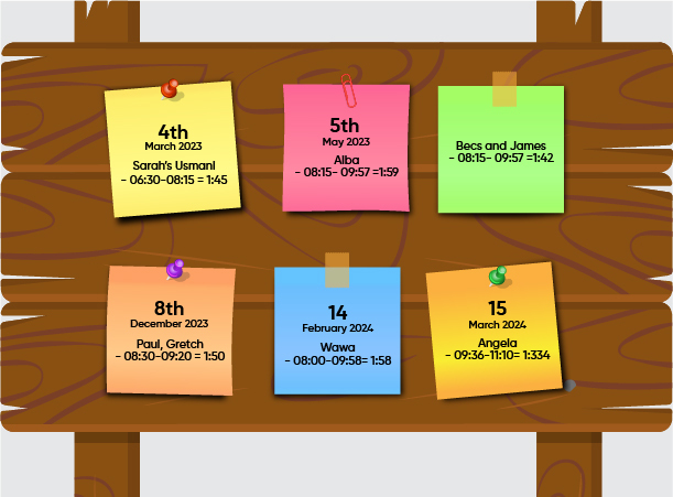
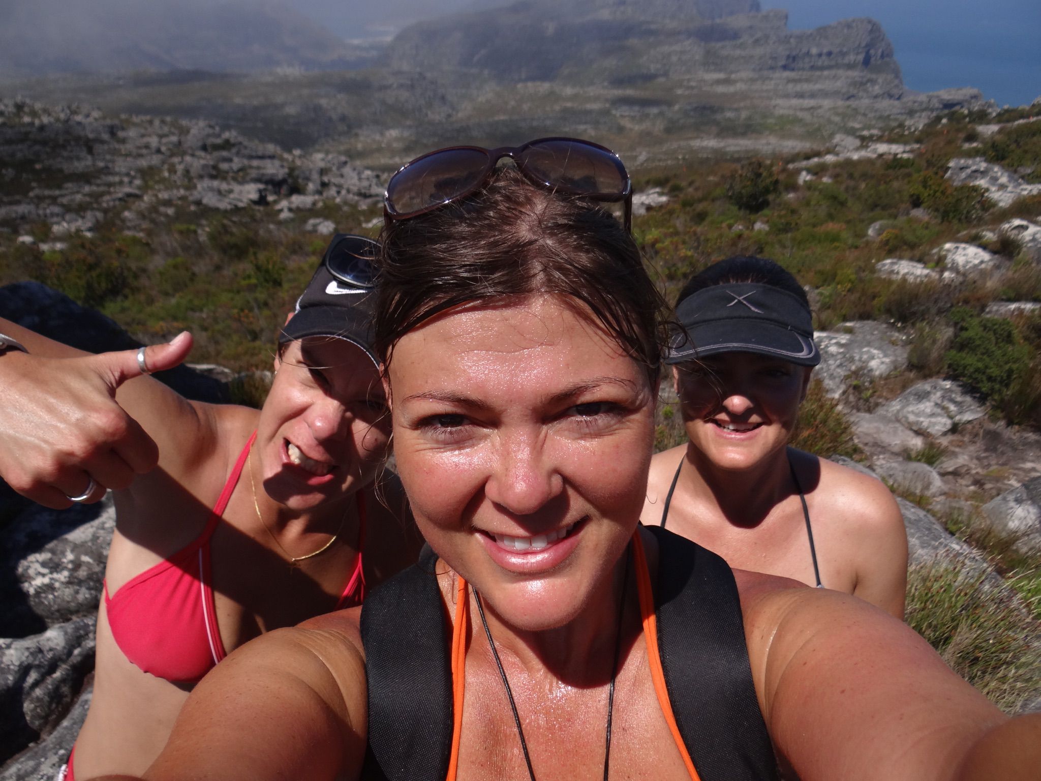
Here at Saffiwi’s, we’re an adventurous bunch and like nothing more than to explore all trails, hikes and walks that the Mother City has to offer. One of our favourite things to do is walk up Table Mountain.
Cue the Platteklip Gorge Challenge!
This popular walk takes you up the face of Table Mountain, on a vertical staircase, that will really test your cardiovascular fitness.
Here are just a few other walks that we like to enjoy. If you find one that you think deserves a place on our wall, please let us know!